
![]()
We have access to following collections:
• Environment
• Geology
• Historic
• Marine
• Ordinance Survey
You can
• View, annotate and print maps from a variety of geospatial data providers
• Download geospatial data for use in CAD and GIS systems
• Access information about geospatial data and resources
Karte von Scotland nach Dorret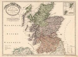
Reproduced by permission of the National Library of Scotland
Provides access to:
Geology of Britain Viewer
A simple tool, aimed at the general public, which helps you explore the geology where you live.
The UK Soil Observatory (UKSO)
A collaboration of institutions providing and delivering information about the diverse soil types of the UK. The UKSO map viewer is free and easy to use, and has some of the most accurate soil data for the UK available.
The groundwater levels timeline map
Provides online access to a timeline of monthly groundwater levels across the UK from 1970 to the present day.
BGS maps portal
Provides high resolution viewing of images of almost all small and medium scale maps produced by BGS since mapping started in 1832.
Open-loop ground source heat pumps
A tool developed by the BGS in collaboration with the Environment Agency that provides an indication of whether the conditions for ground loop systems exist in a given area.
BGS Infiltration SuDS map
Provides an assessment of the suitability of the subsurface for the installation of infiltration sustainable drainage systems (SuDS).
GeoIndex (offshore)
Shows the range of marine geoscience data held by the BGS within the National Geoscience Data Centre (NGDC).
GeoIndex (onshore)
Freely available
The Map images resource from the National Library of Scotland allows you to access and view over 48,000 maps as high-resolution, colour, zoomable images. The maps date between 1560 and 1961 and relate primarily to Scotland, though there are a small selection of maps of England, Ireland, Great Britain and Belgium.
With around two million cartographic items, the NLS map collection is the largest in Scotland and one of the biggest in the world. Holdings cover all parts of the globe, through some 700 years, from medieval manuscript maps to current digital mapping. If you cannot find what you are looking for online, it may be available in print.